

Shoalwater Bay berm monitoring
The U.S. Army Corps of Engineers gave us funding to survey the beach and nearshore along Graveyard and Empire spits on the north shore of Willapa Bay in Pacific County. We monitored how a flood-protection berm, built by the Corps in 2012, changed over time.
Mapping strategy
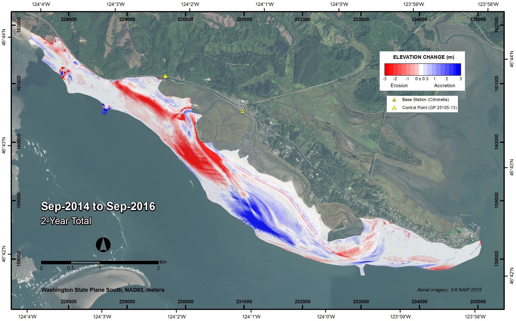
We collected semi-annual data from September 2014 through September 2016 using a combination of multi-beam bathymetry, boat-based Lidar, and ground-based GPS topography to produce a continuous digital elevation model of the survey area. We have gathered critical data to help determine potential risks to the Corps' berm as well as state infrastructure such as State Route 105.
Findings
During this two-year period, our analyses showed that the west end of the berm experienced significant erosion, retreating by 1,115 feet along its center axis. The upper and lower beach faces, adjacent to and offshore of this section, also eroded.
There was a net gain of transported sediments toward the southeast, resulting in an accumulation of nearly an equal volume of sediment across the beach face and nearshore region seaward of the central section of the berm. The crest elevation of the berm southeast of the eroded section lowered by an average of 0.7 meters while also widening and aggrading on the landward side.
Northwest of the project site, Graveyard Spit experienced significant shoreline retreat and overwash, especially during the 2015-16 El Niño winter. For the first time, this erosion exposed SR-105 to wave action along the backside of the barrier. Graveyard Spit is sediment starved and will likely continue to erode without adding external sediment.
Related links
Contact information
George Kaminsky, PhD, PE
Coastal Engineer
george.kaminsky@ecy.wa.gov
360-407-6797