

Mapping Puget Sound bluffs and beaches
We conducted a series of boat-based lidar surveys at 16 sites spanning about 135 miles of shoreline and more than two dozen drift cells from 2013 through 2016. This critical work by our Coastal Monitoring and Analysis Program (CMAP) staff collected high-resolution, topographic data about Puget Sound beaches and bluffs.
Mapping strategy
We used boat-based lidar and GPS topography data to produce 0.5-meter digital elevation models for beaches and bluffs at each of the sites we surveyed. These models afford us the opportunity to inventory and characterize the shoreline landscape affecting the nearshore ecosystem. These features include:- Feeder bluff activity
- Beach slope and width
- Armoring position, length, and elevation relative to the back shore
Using the data
In the future, repeat surveys will enable us to analyze changes in quantifying bluff sediment supply and marine riparian vegetation. This will help us gain a better understanding about the links between physical and ecological processes.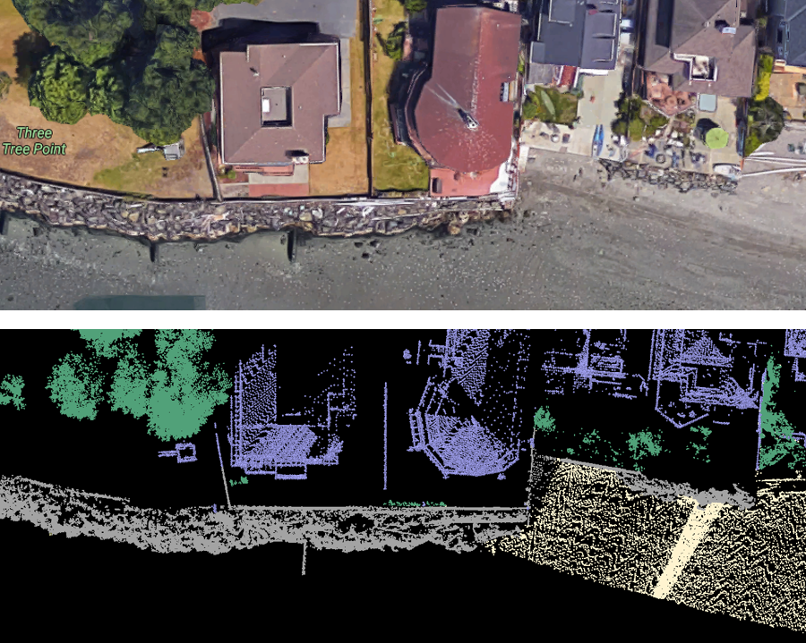
The drift cells were selected based on a geospatial analysis of bluff-backed beaches:
- With a high potential for significant bluff sediment to supply intact shorelines.
- Containing suitable habitat for forage fish, eelgrass, herring, and shellfish.
- In which previous investments have been made for beach restoration projects.
- That have potential for future shoreline armoring and habitat loss based on population growth scenarios.
Related links
Contact information
George Kaminsky, PhD, PECoastal Engineer
george.kaminsky@ecy.wa.gov
360-407-6797